
Land Cover Mapping (Remote Sensing Applications Consultants) (IPP funded)
http://rsacl.co.uk
Overview
Remote Sensing Applications Consultants (RSAC) offers bespoke land cover and land use mapping services based on Sentinel and commercial high- resolution satellite Earth observation (EO) data.
Present day and historical output maps are suitable for development planning, including site suitability analysis relating to REDD+ afforestation projects, and input to natural capital valuation systems.
Solution benefits
- Bespoke land cover and land use mapping services.
- Present day and historical maps.
- Outputs are suitable for development planning, including site suitability analysis (e.g. for afforestation), and input to natural capital valuation systems.
- Repeat mapping provides information to the land use, land use change and forestry sector on changes and the drivers of change to improve reporting, for example, on carbon emissions.
Key technical features
- Standalone solution, though outputs can be usefully integrated with other layers in a geographic information system (GIS).
- Uses free Sentinel data and other commercial high-resolution satellite data, depending on the user/customer needs.
- Uses large volumes of multi-temporal radar and optical data processed in a cloud environment.
- Classification accuracy varies depending on terrain mapped, typically around 85%.
- Spatial resolution of 10 metre.
- Update frequency according to user needs, typically 1-10 years.
- Outputs delivered as vector or raster layers for incorporation into a GIS.
Case studies
In the San Martín Region of Peru, a baseline inventory of land use has been produced from Sentinel-1 and Sentinel-2 satellite imagery as the basis for natural capital valuation activities, in an IPP supported project with Vivid Economics. The overall accuracy of the classification, which in this case included 10 land use classes, was independently determined to be 88%. The information is being used by the regional government to improve its understanding of changes driven by coffee and cocoa cultivation.
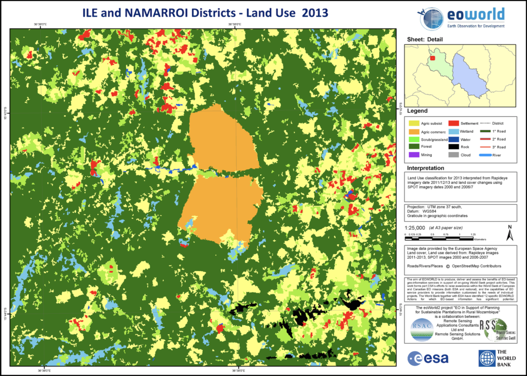
To support World Bank activities to promote sustainable economic development in Mozambique, RSAC supplied land cover and land use maps from very high-resolution satellite data for three historical time periods. The maps provided information required to assess candidate sites for pulpwood plantation development, including the physical suitability of land for growing trees and its capacity to meet sustainability criteria, which include impact of developments on local communities and the ecosystem.
Organisation overview
RSAC is an SME with 30 years of experience providing specialist services to developers and users of Earth Observation. The company has considerable expertise in the use of satellite optical and radar data for land applications worldwide, particularly in the field of agriculture.
The company is involved in a range of research, development and operational activities, playing a leading role in agricultural applications of remote sensing in the UK and heading up several international development projects.