exactTrax – Safety and Tracking Initiative for Small Vessels (OASIS-TU/MSIS-TU) (exactEarth Europe Limited) (IPP funded)
www.exactearth.com/products/exacttrax
Overview
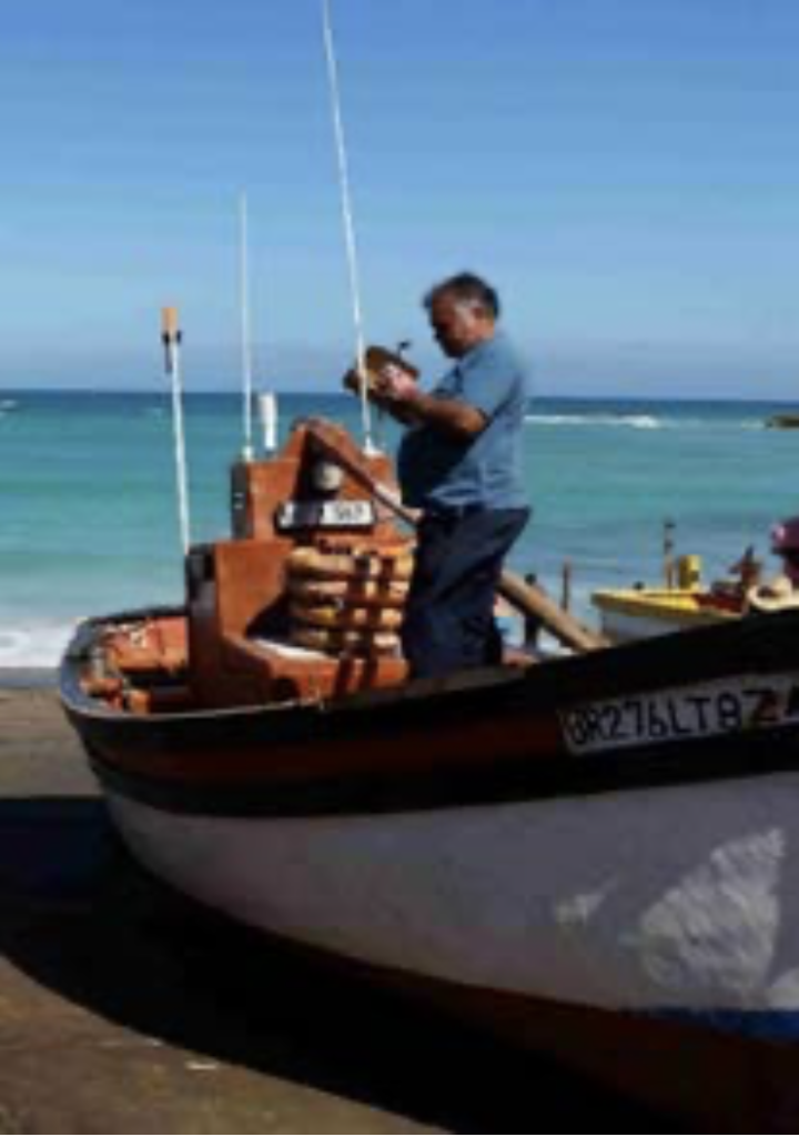
Loss of life from small boats at sea, particularly fishing vessels, is a persistent and extensive global problem. Small-scale fisheries are also under threat in many areas of the world from global warming and over / illegal fishing. Small vessels also make up significant proportions of many nations’ overall boat populations, but can often be involved in illegal activities such as smuggling of people, arms, drugs and resources.
exactTrax supports the real-time, highly cost-effective, satellite tracking of small vessels equipped with simple-to-deploy transponders. Being standards-based, exactTrax also supports collision avoidance with bigger vessels, and improved maritime safety through a transponder’s in-built alert mode.
Solution benefits
- Improved safety of life for small boat operators and crew, regardless of whether operating inshore • or offshore/open ocean.
- Improved small-scale/artisanal fisheries management.
- Improved maritime awareness / maritime security via small vessel tracking.
- Easy to deploy: on-board transponders applicable
to any size/type of boat – from a sail-powered wooden pirogue with no on-board infrastructure • to an industrial fishing vessel. - Very cost-effective both in terms of transponder costs and satellite airtime.
- Attractive low-cost alternative to satellite-based Vessel Monitoring System (VMS) for small-scale/artisanal fishing boats.
- Global transponder tracking and safety alert information provided in real-time via exactEarth’s 60+ satellite Automatic Identification System (AIS) constellation.
Key technical features
- A wide range of exactTrax-enabled transponders are available; all are battery operated and designed to be deployed on boats with little or no on-board infrastructure. In-line battery charging is via solar- power or on-board DC power if available, or batteries can be charged off-line via mains power.
- Each transponder provides regular position information that can be detected in real-time by exactEarth’s satellite AIS constellation, terrestrial AIS networks (if available), and any neighbouring ship equipped with an AIS transceiver.
- Each transponder contains a safety alert function, which can be activated by the crew in the event of an incident at sea. Transmitted alert information can be detected in real-time by exactEarth’s satellite AIS constellation, terrestrial AIS networks (if available), and any neighbouring ship equipped with an AIS transceiver.
- Transmitted location and safety alert data is standards-based – based on the IMO’s international AIS standard.
- Tracking and safety alert data is provided to end-users via a web browser, SMS and smartphone applications.
- Transponders can be deployed and detected in any part of the world, including polar latitudes.
- Tracking and safety alert data can be provided
to organisational users via NMEA feeds and/or OGC-based web services; transmitted transponder data integrates automatically into existing terrestrial AIS networks. - exactTrax uses a combination of AIS and ASM VHF frequency transmissions; the latter means that satellite detection rates remain good in areas of the world where shipping densities and/or the terrestrial radio noise floor are high.
Case studies
Under the UK Space Agency’s International Partnership Programme (IPP), exactTrax has been operationally implemented in South Africa in collaboration with the South African Maritime Safety Authority (SAMSA), the National Sea Rescue Institute (NSRI) and Marine Data Solutions (MDSol). With the support of SAMSA, exactTrax has also been operationally adopted by Ovenstone Agencies (PTY) Ltd for its lobster fishing concession in Tristan da Cunha.
Under a new IPP extension, exactTrax is now being operationally deployed in Madagascar in collaboration with two commercial companies
– Stone Three Communications (South Africa) and Ibonia (Madagascar), and a number of Madagascan government departments including the CFIM (Le Centre de Fusion d’Informations Maritimes); the APMF (l’Agence Portuaire, Maritime et Fluviale); ARTEC (L’Autorité de Régulation des Technologies de Communication); COFONA (Le Commandement des Forces Navales); and the CSP (Le Centre de Surveillance des Pêches).
Pilot trials of exactTrax, again with the support of the IPP and SAMSA, have also been successfully run in Namibia, Mozambique, Mauritius, Tanzania, the Gambia and Senegal, with the Gambia the first of these to subsequently adopt the technology operationally on some of its semi-industrial fishing boats. A pilot trial with Project Abalobi (abalobi.info) in South Africa is also ongoing.
Organisation overview
exactEarth Europe (eEE), with its parent company exactEarth (eE), is a satellite AIS (S-AIS) data services SME, providing the most advanced information on global maritime traffic available today and delivering an unrivalled view of the maritime picture at a global scale. Offering fully secure data in a variety of industry standard formats and delivery methods, eEE’s data provides real value for a wide range of maritime applications delivering operational efficiencies, enhancing security, safeguarding the environment and assisting in saving lives.
eEE has specific responsibility within the wider eE group to innovate (develop, market and sell) new services based on exploiting satellite AIS;
this includes small vessel tracking (exactTrax) and mobile maritime data communications (exactSeNS).
