Dam Monitoring from SATellites (DAMSAT) (HR Wallingford) (IPP funded)
https://tailingsdams.info/
Overview
Dam Monitoring from SATellites (DAMSAT) uses satellite technology to remotely monitor water and tailings dams and other tailings deposit areas. The system will help authorities take preventative action and thus reduce the risk of failure of water and tailings storage facilities and the consequent damage to population and ecosystem services downstream.
Solution benefits
- Increased monitoring capacity by providing frequent monitoring information over wide areas and across remote locations.
- Action timely preventative interventions to reduce the risk of failure and damage to population and ecosystems downstream by receiving abnormal behaviour and weather forecast alerts.
- Consistent monitoring across sites regardless of the relative inaccessibility and hazardous nature of the terrain.
- The wide area coverage allows detecting issues in areas where it might not be expected, areas that are not currently monitored or that are difficult to access.
- More efficient use of resources and improved planning and prioritisation of site visits thanks to available performance information for the sites.
- High- or low-resolution solutions depending on the accuracy and frequency needs.
- Assessment of consequences of dams failures that informs about risk.
Key technical features
- Browser map-based interface with graphical portrayal of data, providing data analysis and a variety of alert management options. Including traffic light status indicators for infrastructure sites of interest.
- Wide area movement monitoring based on Interferometric Synthetic Aperture Radar (InSAR) data using high resolution COSMO-SkyMed Himaq and low resolution Sentinel-1 with quarterly and biweekly updates.
- Real-time movement detection for specific infrastructures using in-situ Global Navigation Satellite Systems (GNSS) receivers, with millimetre precision and at five minute intervals.
- Rainfall, water level and overtopping forecast alerts for storage facilities based on hydrological modelling and weather forecast data from the European Centre for Medium-Range Weather Forecasts (ECMWF) and the National Oceanic and Atmospheric Administration (NOAA).
- ECMFW’s forecast comprises high resolution global deterministic forecast to be produced at nine kilometers grid resolution with a lead time of up to 10 days.
- NOAA freely available GFS forecast data has a resolution up to 30 kilometers with four forecasts per day and a lead time of 16 days.
- Pollution monitoring based on satellite Earth observation (EO) optical data analysis from Landsat, Sentinel and potentially other high- resolution sources.
- Overlays of dam failure flood outlines and consequences based on two-dimensional hydraulic modelling.Cloud platform-based solution running on Siemen’s MindSphere, which provides state of the art security framework compliant with industry standards.
- Cloud platform-based solution running on Siemen’s MindSphere, which provides state of the art security framework compliant with industry standards.
Case studies
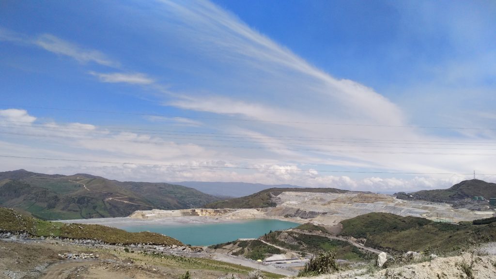
The approach is being tested on a number of water and tailings dams as well as operational, closed and abandoned tailings storage facilities in the mining regions of Cajamarca and Cerro de Pasco in Peru, supported by IPP. This is in collaboration with multinational mining companies and local and national authorities including the Ministry of Energy and Mines and the National Water Authority. The solution will help the authorities and companies to effectively monitor the large number of existing tailings dams and storage facilities, especially those in remote locations, and allow them to take proactive actions.
Organisation overview
HR Wallingford with headquarters in Wallingford in the UK, is a not-for-profit, independent research organisation founded in 1947 specialising in research and consultancy including dams, hydraulics and hydrology and flood risk. HR Wallingford works closely with government and non-governmental organisations worldwide to provide evidence-based tools to support decision making related to dam and flood defence failures and flood risk impacts.
