Playing it Safe: A New Monitoring System for Tailings Dams can Prevent Disasters (IPP Project Blog)
High in the Peruvian Andes, a pilot study to test new remote sensing technology for far-flung tailings dams, using a combination of Earth Observation (EO) and on-the-ground sensing, and numerical modelling, has just come to a close. Craig Goff, a technical director at HR Wallingford, explains the project and the pioneering DAMSAT system, which could be a major contributor to dam safety in the future.
Tailings dams are vital for storing toxic waste from mining worldwide, but the likelihood of them failing is higher than for water dams. Tailings dams are often found in remote locations and frequently in low-income countries that do not have the resources to monitor them effectively. This combination can be a recipe for disaster, causing catastrophes such as the failure of the Brazilian Brumadinho dam in 2019, which released 12 million cubic metres of mining waste, killing around 300 people.
Earth Observation offers new solutions to the challenges of monitoring remote dams and can be used to build apps with the comprehensive ability to observe, measure, qualify and quantify data over wide areas. This new technology can also provide automated, higher frequency data regardless of the relative inaccessibility and hazardous nature of the terrain, and can complement, or sometimes even replace, traditional methods, such as physically visiting the site to conduct surveys. Importantly, this means that these new methods can be cheaper and require less expertise to use than existing methods, making them an accessible solution for dam owners and regulators worldwide.
In 2018, HR Wallingford partnered with the UK Space Agency to develop exactly this kind of system. This project is supported by the UK Space Agency’s International Partnership Programme (IPP), which is funded through the Global Challenges Research Fund (GCRF).
HR Wallingford led an international team to create DAMSAT, which is able to analyse the past, monitor the present, and predict the future. DAMSAT works by spotting changes to the normal behaviour patterns of dams to detect dangerous movement and leakage.
Every dam has its own pattern of behaviour, which includes: expanding and contracting; greening and browning; slowly settling; and steady seepage, so DAMSAT warns users about departures from these. It also compares current and past satellite images to detect changes on site, allowing interrogation of historical evidence. Using weather forecasts, DAMSAT also assesses how heavy rainfall will impact the water level in the reservoir, and the subsequent load on the dam and its ancillary structures.
The system uses a combination of Interferometric Synthetic Aperture Radar (InSAR) and Global Navigation Satellite System (GNSS), to monitor movement. It also uses several wavelengths of optical satellite data to monitor leakage and pollution indicators, and integrates ten-day advanced satellite weather forecasts from either the National Oceanic and Atmospheric Administration (NOAA) or the European Centre for Medium range Weather Forecasting (ECMWF) twinned with hydrometeorological models to predict water level changes in advance.
Usefully, DAMSAT also displays information about the possible impacts downstream if there is a dam breach. To do this the team used cutting-edge numerical models, such as EMBREA and the Life Safety Model (LSM). EMBREA is a breach model that simulates complex modern dams, and the Life Safety Model helps with the development of emergency plans by assessing the risks to people and evacuation times for various scenarios. In fact, LSM represents the behaviour of each individual person, vehicle and building and their interactions with the floodwater and mud.
Alongside its EO and modelling components, DAMSAT is able to add in situ sensors, or complement existing ones, to allow real-time measurement and for independent calibration and validation of measurements from the EO datasets.
All this information is then integrated into a cloud-based platform which generates alerts for behavioural changes or unusual weather conditions that could cause infrastructure failure. And DAMSAT is not a one-size-fits all solution, but rather is made up of a number of modules that can be selected to best suit the particular dam and the users’ needs. This may mean incorporation of historical monitoring device data streams, higher or lower resolution data, general surveillance of the dam or more targeted monitoring of an existing area of concern.
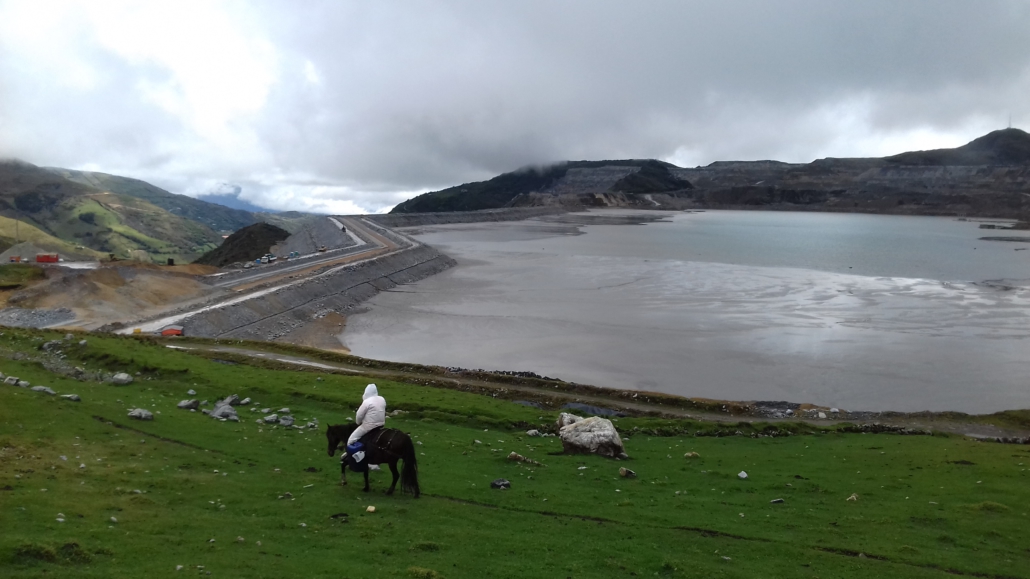
After its development, DAMSAT was tested at 31 tailings dams and tailings deposit slopes in the Cajamarca and Pasco regions of Peru. Peru was a great choice to test the new system as it has a long history of mining. It has some of the largest reserves in the world of many metals including silver, zinc and gold and the largest reserves of any country in South America. Abandoned and illegal mines are a major problem in Peru, and cause real problems with monitoring. So, the industry is crucial to the economy, but it also generates social discontent and inequalities because of its impact on livelihoods and ecosystems.
To test the system, the DAMSAT team worked with the Peruvian institutions responsible for areas related to dam monitoring and EO technologies. These included: the National Space Agency; mining authorities; regulators in the water and environmental sectors; and local authorities. This allowed the team to refine the system to best suit the end users, identify improvements before it was complete, and ensured the final product had received end-user approval. During the pilot study, DAMSAT identified leakage incidents at tailings dams and provided information that helped in-country partners to analyse minor movement incidents.
The challenges faced whilst developing DAMSAT were numerous. To overcome all the technical challenges, the team comprised dams engineers, hydrologists, earth observation scientists, mining consultants, software developers, cloud computing specialists, numerical modellers and statistical experts.
But that was the easy part. Much more challenging was getting the pilot project up and running in Peru, where the team was working in a developing country with many different government agencies. Within the three-year duration of the project, Peru had eight different Prime Ministers, leading to a high staff turnover within the organisations testing the system.
Following the initial trial on tailings dams, the pilot was also extended to include water dams. Whilst the statistical risk of failure for these dams is lower, there are many more of them and they are often in hard-to-reach locations. Certainly, these dams represent a risk to populations downstream, as was seen recently with near-misses at Oroville in the US in 2018, and at Toddbrook Reservoir above the UK town of Whaley Bridge in 2019.
So what’s next for DAMSAT? Given the success of the trials in Peru, DAMSAT is now available for commercial use, for both tailings and water dams. Systems are currently under construction for all of the large reservoirs belonging to a major UK water company, and for other dam owners globally. It’s hoped that the leading-edge technology will increase the effectiveness, and drive down the costs of dam monitoring, particularly important in some of the world’s most underdeveloped nations. And, if this aim can be achieved, then tragedies on the scale of Brumadinho may be averted in the future.


