EASOS Data Discovery Hub (Geocento) (IPP funded as EASOS project)
http://geocento.com/
Overview
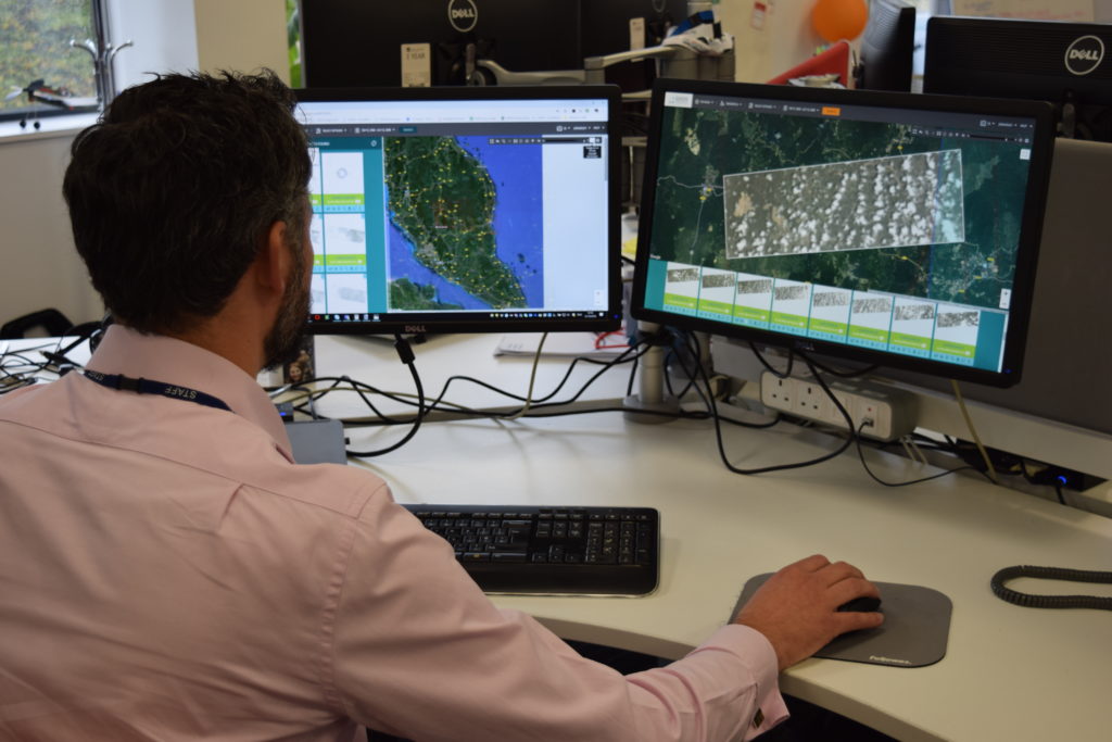
EASOS Data Discovery Hub is a user friendly, one stop shop, web platform that can be used to discover, select, order, receive, visualise and download Earth observation (EO) data, with convenient filtering tools. It provides efficient and independent access to imagery from the range of image suppliers to help monitor and assess areas of concern to authorities in terms of illegal activity, accidents and natural disasters.
Solution benefits
- Ongoing access to EO data collected by all the major image suppliers, including free EO data, providing flexibility in covering events and locations with the most appropriate EO data. For example, EO data that can be tasked to identify oil spills through cloud, to data that can monitor deforestation.
- User friendly, one stop shop, web platform that can be used to discover, select, order, receive, visualise and download EO data, with convenient filtering tools.
- Subscription based service that allows access to EO data from multiple sources, without the need to select in advance, avoiding tie in to single supplier solutions.
Key technical features
- The platform has information on over 56 million existing EO images, a multi-mission planning engine that provides details on future imaging opportunities for image tasking and access to free imagery from Copernicus and Landsat.
- Standalone, cloud-based web platform that can be white labelled, powered by an application programming interface (API) from Geocento.
- Combines both free EO data and commercial EO data, including optical and radar, ranging from 30 metre resolution down to 25 centimetre resolution.
- Scans image supplier catalogues multiple times a day to create “meta-catalogue” of existing EO data that is then made discoverable via API. The Geocento online service (API) underpinning the platform receives 4500 search requests for imagery per day.
- Includes multi-mission planning for satellite imaging opportunities and planning constraints for forward planning of new acquisitions, plus includes (where published) image acquisition plans.
- Includes order management application for image purchases, and direct download of non- commercial imagery, along with e-commerce for PAYG.
- Image hosting, full resolution viewing and download, as well as an image sample server that provides access to example imagery before you buy.
- Hosting for image processing algorithms is supported.
Case studies
Geocento is used as the platform for planning and accessing EO data in the EASOS project in Malaysia supported by IPP. The project aids the government across the forestry, marine pollution and disaster resilience (flooding) domains. The platform was used recently to identify suitable imagery related to deforestation in Malaysia, with one result being the detection of an illicit timber processing shed.
Organisation overview
Geocento’s mission is to “make imagery accessible”. It has pursued this goal by developing web-based technologies to access imagery (currently used under license by several industry leading EO companies), developing a wide network of satellite (and also airborne) image suppliers, and using digital marketing to create a rapidly growing pipeline of imaging opportunities around the globe. The company is based in Harwell with a subsidiary in Villafranca del Castillo, Spain.