Watershed Management (Rezatec)
https://www.rezatec.com/services/water-management/water-quality/
Overview
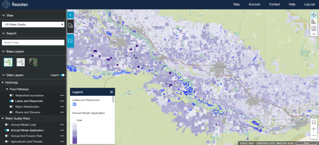
Effective catchment management is vital for water companies to achieve water quality without having to undertake expensive treatment downstream. This means mapping, measuring, monitoring and predicting change across landscapes within catchments in order to better understand the relationship between land use and water quality. Until now, water companies have found it difficult to achieve this level of insight across large catchments with any frequency without a heavy reliance on costly ground resources. The product provides regularly updated Earth observation (EO) based analytics to understand land use and engage with local land owners, meet regulatory compliance, and reduce water treatment costs for effective watershed management.
Solution benefits
- Use regularly updated analytics to understand land use and engage with local land owners, meet regulatory compliance, and reduce water treatment costs.
- Map agricultural land use at field level across a large area to identify hotspots of agricultural pollution polluting the water catchment.
- Predict future diffuse pollution based on the crop growth cycle and other agricultural uses.
- Improve management of water abstraction by predicting changes in diffuse pollution based on precipitation and water flow.
- Communicate easy-to-interpret information to a wide range of water quality stakeholders and land owners to support engagement programmes that reduce the need for costly water purification.
- Analytics delivered via web-based portal or integrated into existing GIS systems.
Key technical features
- Multi-spectral Sentinel satellite EO data combined with proprietary algorithms allows identification of crop types with a high level of accuracy.
- Monthly updates allow for both summer and winter land use mapping and crop identification.
- It allows monitoring of large water catchment areas and identification of sources of pollution not currently identified.
Case studies
Working with Metro Pacific Water to improve the availability of drinking water in the metropolitan city of Manila in the Philippines. Using pioneering EO data processing techniques and proprietary algorithms, Rezatec analysed agricultural and urban land use and modelled the natural hydrology around Laguna Lake – the largest lake in the Philippines – to produce a land-use map to identify diffuse sources of urban, industrial and agricultural pollution, hydrological attributes and rainfall run-off models.
Organisation overview
Rezatec applies data science to satellite imagery and geospatial data to deliver sophisticated, cloud-based analytics to customers owning and operating high value, distributed land-based assets. Rezatec data services enable improved margins, enhanced competitive advantage and optimised asset management for its customers. Rezatec customers cover the globe and are leaders in their respective industries in the water, agriculture, infrastructure and forestry sectors.