Flood Risk Management Systems and Data (Ambiental Risk Analytics)
Overview Over
Overview
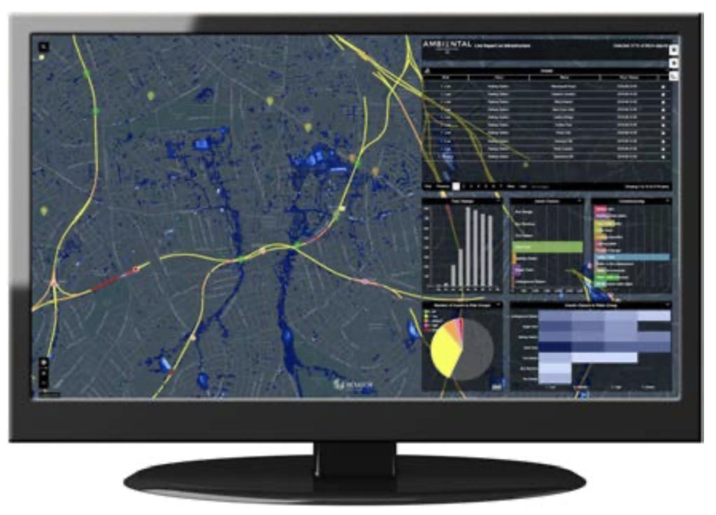
Effective flood risk management requires clear and current information to make informed decisions. Ambiental produces high precision flood data in the form of hazard maps and flood risk analysis quantifications. Using a systems approach enables end-users in government, disaster response, insurance and the private sector to better prepare for and respond to flood emergencies.
www.ambientalrisk.com

Solution benefits
- Easily visualise data, share insights and configure alerting protocols through the use of intuitive, web-based dashboard applications.
- A worldwide flood forecasting capability for advanced warning of flood events, based on dynamic modelling of live data feeds such as rainfall radar, forecast models and hydromet telemetry.
- An automated end-to-end workflow solution with powerful geospatial tools for customising views of data layers and analysing flood impacts.
- Flexible and highly scalable deployment option which can be deployed on enterprise systems or delivered as a cloud-hosted service
Key technical features
- Digital flood risk products underpinned by Ambiental’s Flowroute modelling technology – tried and tested by governments and insurers worldwide.
- Flood forecasting capability delivered using Ambiental’s FloodWatch software – full catchment continuous 2D coupled hydrological/hydraulic simulation of floods up to 7 days in advance.
- Able to ingest a range of data types, including WMS and API feeds – systems can incorporate remotely sensed data of land use, topography and satellite weather monitoring.
- Uses high-performance computing for rapid results and machine learning for automated calibration – to ensure long warning lead times and improved predictive accuracy.
- Solution delivered through a range of front- end visualisation technologies and back-end processing servers – software delivered as a service and tailored to a client’s budget and requirements.
Case studies
A high-resolution pluvial flood forecasting system and risk visualisation platform was developed for Greater London. The system provides flood hazard predictions, risk quantifications and alerting tools. Met Office rainfall forecasts are processed and flood risk is quantified through live impact forecasting to a range of asset types. Working with stakeholders at The Greater London Authority and Transport for London flood risk to the transport network is calculated and visualised. In this project remotely sensed data was processed and visualised to detect changes in greenspace. Also, natural language processing is used to extract contextual information on flooding from social media feeds.
Organisation overview
Ambiental is a global specialist in flood risk assessment and risk management. A company of Royal HaskoningDHV, Ambiental provides flood forecasting systems using flood modelling techniques that support better decision-making around flood risk management by predicting the location and severity of flooding, preventing damage and protecting people, property and assets. The company produces flood maps,
data sets, catastrophe models, flood forecasting products and environmental reports internationally. Ambiental conducts both rapid assessments and in-depth research that support better decision-making around flood risk management.
